

Original Records | Books at the Library | Microfilm at the Library | Online Resources | Maps by Year
Original Records
LaPorte County deeds and historic property records are available through the La Porte County Recorder’s Office. Copies may be made for a fee. A computer is available to assist with your research.
La Porte County Recorder
555 Michigan Avenue, Suite 201
La Porte, IN 46350
(219) 326-6808 ext. 2280/2234/2209
https://laporteco.in.gov/departments-online/county-recorder/
Recent LaPorte County property information, maps, real estate data, tax information, and appraisal data are available online through Beacon.
Many county-recorded land records, including mortgages, deeds, and other documents, are available online for a fee through Tapestry. Indexing and scanned documents appearing in Tapestry are current to the last business day. Deed images and indexes are available back to December, 1920. Other document images and indexes are available back to 1969.
The Indiana State Digital Archives includes records from the state land offices at LaPorte-Winamac (1833-1855), Fort Wayne, and Vincennes. These records are a good source of information about early settlers in the state. Other state land records, including field notes, plant maps, and land office tract book entries, are available at the Indiana State Archives:
Indiana State Archives
6440 East 30th Street
Indianapolis, IN 46219-1007
317-591-5222
http://www.in.gov/icpr/2722.htm
The Bureau of Land Management has tract books and records of land entry cases (property transferred from the government to private ownership) for the eastern states, including Indiana. Records that are unavailable online may be requested by mail. They also have online access to federal land patents, survey plats, and land status records for many states:
Eastern States Office, Bureau of Land Management
Department of the Interior (BLM-ESO)
7450 Boston Boulevard
Springfield, VA 2215
Land entry case files (property transferred from the government to private ownership) are held by the National Archives. Genealogists can request the files online or by mail using NATF Form 84, Request for Copies of Land Entry Files:
Old Military and Civil Records
National Archives and Records Administration
Room 11 E
7th and Pennsylvania Ave NW
Washington, DC 20408
E-mail:inquire@nara.gov
Books at the Library
General
Land & Property Research in the United States. E. Wade Hone. Genealogy Collection, General Hone
LaPorte County
Index to La Porte County (IN) Tract Book. Compiled by Fern Eddy Schultz. Genealogy Collection, LaPorte County Index
LaPorte – Winamac Land Office Entries, 1833-1855. Tract Books Transcribed by Barbara S. Wolfe; Data Compiled by Helen Morrison. Genealogy Collection, LaPorte County LaPorte
Insurance Maps of La Porte, 1907: La Porte County, Indiana. Atlas Case, Insurance 1907
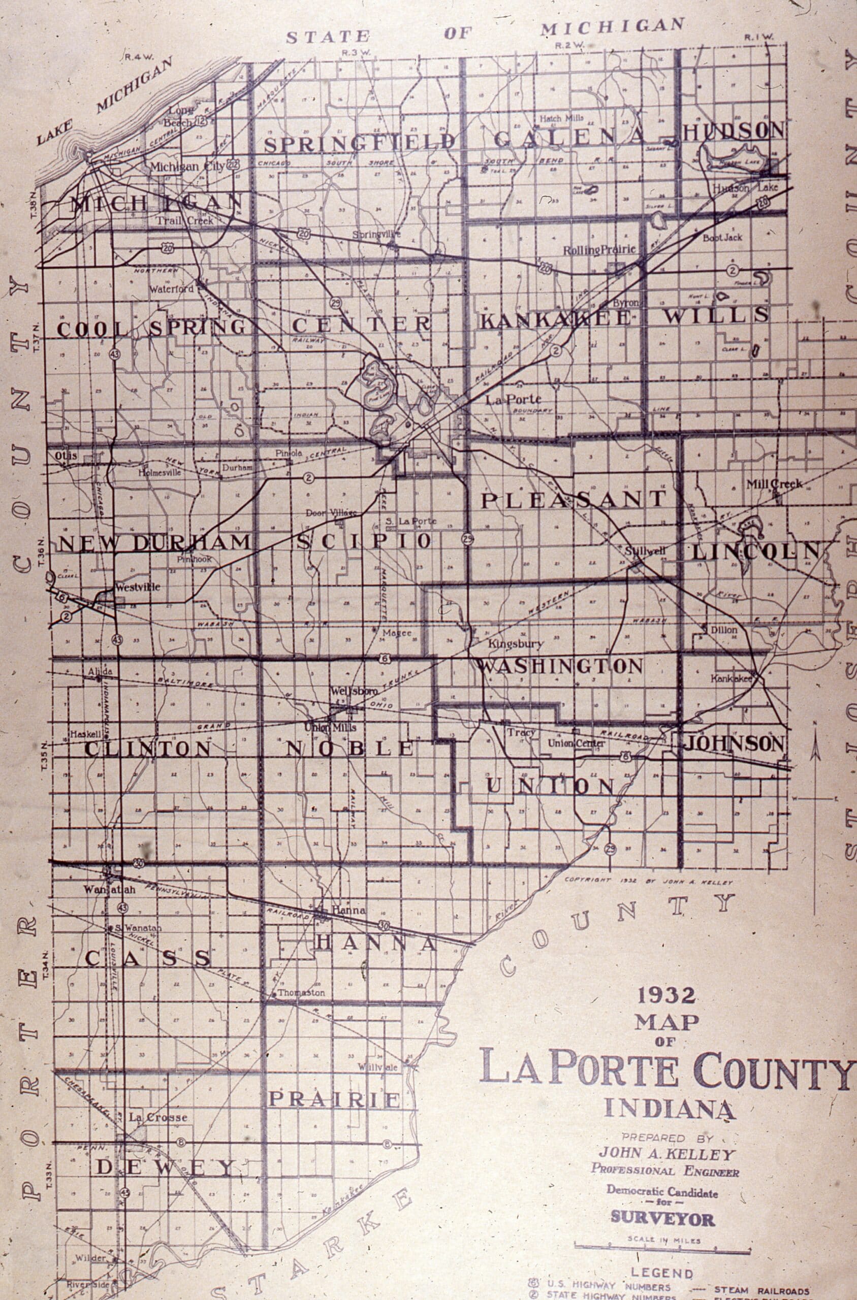
Combined Atlases of La Porte County, Indiana, 1874, 1892, 1907, 1921 and Plat Book, 1892. Atlas Case, La Porte
An Illustrated Historical Atlas of LaPorte Co., Indiana. Compiled, Drawn & Published from Personal Examinations & Surveys by Higgins, Belden & Co., Chicago. Atlas Case, La Porte 1874
LaPorte County, Indiana: Geo. A. Ogle & Co’s Standard Atlas. Compiled and Published by Geo. A. Ogle & Co. Atlas Case, La Porte 1921
LaPorte County, Indiana Plat Book. Years 1958, 1969-70, 1971, 1973, 1978, 1978-9, 1984, 1988, 1994, 1998, 2003, 2007, and 2009. Indiana Collection, 977.291 L3179
Map of La Porte Co., Indiana, 1862. Atlas Case, La Porte 1862
Michigan City Indiana Directory Including Taxpayers for La Porte County and LaPorte Indiana City Directory Including LaPorte County Taxpayers. Indiana Collection
Official Street Index Book of La Porte County. Indiana Collection, 977.291 OF2
Abstract of Title to Duneland Beach. Indiana Collection, 977.291 AB89
Map of Long Beach. Atlas Case
Michigan City, Indiana, January 1884 (Sanborn Insurance Map). Atlas Case, Insurance 1884
Index to Atlas of Michigan City, Indiana. Atlas Case, Michigan City
Index to Atlas of Michigan City & Suburbs, Indiana. Michigan City Real Estate Board, Inc. Atlas Case, Michigan City 1960
Indiana
Maps of Indiana Counties in 1876: Together with the Plat of Indianapolis and a Sampling of Illustrations. Atlas Case, Indiana
Indiana’s County Maps. Researched, Compiled and Designed by C. J. Puetz. Atlas Case, Indiana
Indiana Atlas & Gazetteer: Detailed Topographic Maps. Atlas Collection, 912.772 IN2
Indiana Land Entries. Margaret R. Waters. Genealogy Collection, Indiana Waters
Fort Wayne Land Office Entries, 1823-1852. Tract Books Transcribed by Barbara S. Wolfe; Data Compiled by Helen S. Morrison. Genealogy Collection, Indiana Fort
Allen County, Indiana, Plat Book: Index of Owners, City Street Maps. Genealogy Collection, Indiana Allen
Carroll-White Counties, Indiana, Plat Book: Index of Owners, City Street Maps. Genealogy Collection, Indiana Carroll
De Kalb-Steuben Counties, Indiana, Plat Book: Index of Owners, City Street Maps. Genealogy Collection, Indiana De Kalb
Gibson County, Indiana Plat Book: Index of Owners, City Street Maps. Genealogy Collection, Indiana Gibson
Hamilton County, Indiana Plat Book: Index of Owners, City Street Maps. Genealogy Collection, Indiana Hamilton
Hancock County, Indiana, Plat Book: Index of Owners, City Street Maps. Genealogy Collection, Indiana Hancock
Henry County, Indiana, Plat Book: Index of Owners, City Street Maps. Genealogy Collection, Indiana Henry
Jackson County, Indiana Plat Book: Index of Owners, City Street Maps. Genealogy Collection, Indiana Jackson
Jasper County, Indiana, Plat Book: Index of Owners, City Street Maps. Indiana Collection, 977.2977 J312
Jeffersonville Land Entries, 1808-1818. Compiled by Janet C. Cowen. Genealogy Collection, Indiana Jeffersonville
Knox County, Indiana: Early Land Records and Court Indexes, 1783-1815. Compiled by June B. Barekman. Genealogy Collection, Indiana Know
Knox County, Indiana, Plat Book: Index of Owners, City Street Maps. Genealogy Collection, Indiana Knox
LaGrange County, Indiana, Plat Book: Index of Owners, City Street Maps. Genealogy Collection, Indiana LaGrange
Land Owners: Miami County, Indiana, 1877. Compiled by Robert D. Smith. Genealogy Collection, Indiana Land
Porter County, Indiana, Plat Book: Index of Owners, City Street Maps. Indiana Collection, 977.298 P833
St. Joseph County, Indiana, Plat Book: Index of Owners, City Street Maps. Indiana Collection, 977.289 SA25
Starke County, Indiana, Official Farm Plat Book and Directory. Indiana Collection, 977.2923 ST28
Other Areas
Atlas of Historical County Boundaries. Volumes covering Alabama, Connecticut, Delaware, the District of Columbia, Florida, Illinois, Indiana, Kentucky, Maine, Massachusetts, Maryland, Michigan, Mississippi, New Hampshire, New York, North Carolina, Ohio, Pennsylvania, Rhode Island, South Carolina, and Wisconsin. Atlas Case.
Township Atlas of the United States. Jay Andriot. Genealogy Collection, General Township
Bounty and Donation Land Grants in British Colonial America. Lloyd deWitt Bockstruck. Genealogy Collection, Colonial Families Bockstruck
Note: the library has many additional titles covering land records and maps in Illinois, Kentucky, Maryland, Michigan, New Jersey, New York, North Carolina, Ohio, Pennsylvania, Tennessee, Virginia, and other areas in the U.S. and other countries. Please check the catalog or ask at the Reference Desk for assistance.
Microfilm at the Library
LaPorte County Court records – Includes deed records (1833-1901), tax deed records (1863-1923), partition records (1863-1926), probate records (1832-1922), and will records (1844-1921). Also available through FamilySearch.
Sanborn Fire Insurance Maps – The library holds Sanborn fire insurance maps of Michigan City dated January 1884, September 1889, July 1899, December 1905, May 1912, November 1922, April 1929, May 1936, and August 1948 on microfilm. Sanborn maps from 1884 and 1907 are also available in print in the Indiana room.
City directories – Available on microfilm and in print.
Census records – Various holdings from 1790-1930.
Three ViewScan 4 microfilm readers are available for free public use in the Reference Department. Please ask at the Reference Desk if you have any questions. Prints are $0.15 a page. PDFs and images may also be saved to a flash drive or emailed for no charge.
Online Resources
Beacon – LaPorte County real estate and GIS database
Tapestry – LaPorte County recorded land documents (current and many historical). Fee-based service
Elston Grove – National Register of Historic Places registration form
Franklin Street Commercial Historic District registration form
Haskell and Barker Historic District registration form
Deed Records, 1833-1901; Indexes to Grantees and Grantors, 1832-1903, La Porte County – FamilySearch
Partition Records, 1853-1926, LaPorte County Circuit Court – FamilySearch
Tax Deed Records, 1863-1923, La Porte County – FamilySearch
Michigan City probate order books, 1899-1920; complete record, 1901- 1919; will record, 1898-1920; partition record, 1898-1916 – FamilySearch
Indiana Historic Buildings, Bridges, and Cemeteries Map
Sanborn Maps at the Library of Congress – Includes Michigan City 1884 & 1899 and La Porte 1884, 1886, 1890 & 1895
LaPorte County Historic Slide Collection – Includes some house photos, plat maps, and Sanborn maps
Portable LaPorte County – 1970s booklet with information about historic sites, including some houses, in LaPorte County
1921 LaPorte County township maps -LaPorte County INGenWeb
Indiana State Digital Archives – State land office records
Historic Indiana Atlases – IUPUI University Library Digital Collections
Historic Plat Books of Indiana Counties – IUPUI University Library Digital Collections
Indiana Historic Architecture Slide Collection – IUPUI University Library Digital Collections
Indiana Historic Sites and Structures Surveys – Includes La Porte County Interim Report; IUPUI University Library
Indiana State Historic Architectural and Archaeological Research Database (SHAARD)
Indiana Historic Maps – Indiana Historical Society
Historic Indiana Maps Collection – IUPUI University Library
Indiana Historic Atlases – Ball State University
Indiana County Maps, Atlases, and Plat Books – Print titles available at Indiana State Library
Bureau of Land Management – Land records search
Research in Land Entry Case Files – How to find information on land transferred from the government to private ownership; from the National Archives
Farm Ownership Case Files – Available at the National Archives at Chicago
Ancestry Library Edition – Available within the library
HeritageQuest – U.S. Indexed Early Land Ownership and Township Plats 1785-1898, County Land Ownership Maps 1860-1918, and more. Log in at home with your library card number. Don’t have a library card? Sign up now to get an eCard.